It’s early. That was my dominant thought as I quietly got ready to leave my house just before 5AM. As I walked outside, I quickly realized that maybe it wasn’t early enough… the sky was already too bright for my liking.
On the menu this morning is Piestewa Peak, formerly known to locals as Squaw Peak. As a brief history of the name, it was originally called Vainom Do’ag by the local Pima, which meant “Iron Mountain.” From 1910 to 2008, it was referred to as Squaw Peak. Then, in 2008, after years of political pushing, it was finally renamed. They chose to honor Army Specialist Lori Piestewa. She holds the honor as the first Native woman killed in active combat.
Piestewa Peak is within the Phoenix Mountain Preserve system, a magnificent 37,000-acre wilderness smack dab in the middle of the Valley. The Preserve has only been around since 1973, with Piestewa Mountain Park and the adjacent North Mountain Park as the original preserve. Now it also includes Camelback Mountain, Papago Park, Lookout Mountain, and the Phoenix Sonoran Preserve. It’s right off Lincoln and the 51, touring the north edge of Biltmore, the west edge of Paradise Valley, and northwest corner of Arcadia.
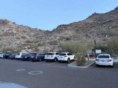
Back to the hike: the whole point of going at 5AM was to arrive as the gates officially open at this point in the year. I arrive at the trailhead at 5:15 to find that the parking area is about 80% full already. Clearly, I wasn’t the earliest. I get a spot close enough to the trailhead though, and start walking towards it. Thankfully the weather is pleasant enough, a balmy 70 degrees. At 5AM. Thank goodness I didn’t wait to do this… next week it’s even warmer.
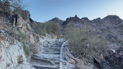
For the record, I haven’t done this hike in a few years. I remember it being steep and rocky, but right off the bat I’m greeted by a surprisingly rough and ready trail with a mix of steep dirt and polished rock steps. Ahead of me is the initial rise composed of several switchbacks. So, I take a deep breath and start working my way up. At the top of this switchback series, I stop to take a breath and to take in the views. I’ve already jumped up in elevation enough to have a commanding overlook of the parking lot and the foothills around the mountain.
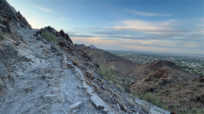
After that the trail goes behind a peak. From there I have a clear view of the peak and a good chunk of the trail between me and my end goal. Most of the trail is clearly visible going up the mountain – just as steep as I remember. After the brief pause to check my progress I keep at it, working my way up the trail that’s anything but even or smooth.
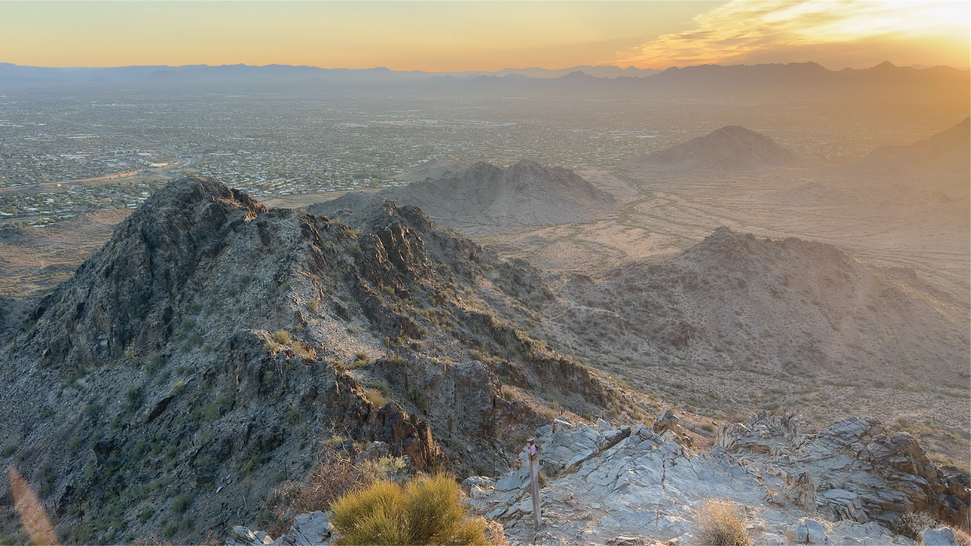
There are several switchbacks that I go up and several false peaks that give incredible views of a beautiful sunrise to the east. It’s hard to keep my eyes on the trail as I keep going up, as the city around me is waking up and turning beautiful shades of orange and pink as the sun creeps over the mountains.
Then, I get to the crux of the hike. The signal, a series of metal bars, comes just as you think you’ve about conquered this peak. They’ve been placed to help hikers have something to hold onto while climbing some of the steepest section of the trail. This area also serves as a frustrating choke point, with hikers taking turns as the trail only has space for about a person and a half on the smooth, bare rock. I slow down a bit, as the hikers that beat me to the parking lot work their way up the metal bars. At the top of this obstacle, I turn another corner and see it – the scramble to the absolute peak. It’s primarily rock, not surprising at this point in the hike. But the elevation gain relative to horizontal distance is daunting.
Thankfully, it looks like this scramble has been improved, as stone steps go all the way up. I’m not sure how helpful that is though, since the steps are narrow, meaning hikers are squeezing past each other to avoid a true rock scramble on either side. I opt to scramble partway up, not satisfied with the speed of my progress. A quick squeeze through two large boulders at the top, a quicker easy climb up the backside of one of them, and suddenly the world opens all around me.

The view makes my strenuous efforts totally worth it. Starlings are darting around me as I look around at the entire 37,000-acre preserve and the surrounding city. It’s magical at this time of the day. Peaceful. Calm. Not super crowded, with only a dozen or so hikers there with me. On a normal winter day, it’s not unusual to have the peak shoulder to shoulder with hikers vying for the view they worked for.
After a moment of repose (and a quick video), I start working my way back down. I’m planning on running most of the way down, but I’m immediately greeted by that steep, rock-stepped climb that I just came up. Let me tell you, the way down is WAY more questionable. The rocks are slick, worn smooth with so much foot traffic. They’re also angled slightly downward. With the narrowness of the steps, I go nice and slow until I hit the bottom of that part.
I start getting into a rhythm to find myself back at the metal bar area. It’s more chocked than before, and it’s only 6AM. I carefully work my way down that and finally it’s off to the races for the last 2/3rds of the hike. I’m back at my car within 15 minutes, drinking water and realizing I really couldn’t have shown up any later. The parking lot I’m in is full – and the ones adjacent are filling up quickly too.
Fun Fact: While this preserve may seem rugged and devoid of life, there’s a surprising abundance. It hosts the usual denizens of the desert: snakes, lizards, bugs, and rodents. This preserve also has a good population of javelina, ringtails, raccoons, coyotes, and bobcats. Very VERY rarely, it can also host a vagabonding mountain lion or black bear. It always impresses me how much life there is hiding in the rocks, ravines, and scrappy bushes.
Congratulations on accomplishing one of the most iconic hikes in Phoenix. After such a vigorous hike, I’d suggest a nice brunch or lunch at Luci’s at the Orchard or Adobe Bar & Grill!